Page 3
Summer 2016
NATURAL RESOURCES PROTECTIVE ASSOCIATION
WHAT CAN ONE PERSON DO?
By Tony Rose
The cyclist follows the rules. He has
lights fore and aft, a number of them.
Reflectors. He wears a helmet. He
stops at lights; (mostly). He never
rides on the sidewalk (well, hardly
ever).
As a bicycle commuter from the
North Shore to the South Shore,
there are two perilous spots he must
encounter daily. One of them is
cles is rutted with potholes, sinkholes
and raised ridges caused by poorly
paved sewer drains. Halfway down,
a manhole cover three inches lower
than the level of the roadway sits like
an alligator just below the surface
waiting to bite chunks from the
wheels of passing vehicles. The
efficiency of this vehicle destroyer is
demonstrated by the broken hub-
caps and chunks of tire littering this
portion of the service road.
Safety lies on the walkway of this
route. Few pedestrians walk this
piece of sidewalk and four feet away,
autos pick up speed as they roar
down this three-lane headed for
Hylan Boulevard or the Verrazano
Bridge.
One problem with riding on this par-
ticular piece of walkway lies in its
hilly topography. Two long stretches
of brick retaining wall hold up the
interrupted spine that traverses Stat-
en Island south to north. The ridge
has been bisected to allow the Stat-
en Island Expressway to cross the
midriff of the island.
Years ago, a heavy storm caused a
landslide to roll down the hill and
cover the sidewalk. Since the result-
ing surface was relatively level, the
city took no notice.
Pedestrians
simply sighed as they walked the
muddy section after a rainfall. The
slope caused a curving walkway to
form that arced towards the road. As
(continued next page)
around the slippery, narrow, elevated
walkway with its crumbling railing
was not for the faint of heart. Unlike
the Avenue V Pumping Station, the
inside was devoid of ornamentation.
Some people in our group asked if
the building could someday be used
as a ferry terminal. But we were told
that the building has serious structur-
al issues and repurposing it, while
not impossible, would be a chal-
lenge.
A few of us walked around to the
back of the building and stood on the
banks of Coney Island Creek. The
water was very clear, but swimming
is out of the question because of the
wet weather flow from the combined
sewage outfall. In addition to the
combined sewer outfall, there are
several enormous storm water out-
falls nearby.
A flood gate has been proposed for
this area, but we have many con-
cerns about it. The New York City
Economic Development Corporation
(EDC) is in the midst of a feasibility
study for flood control measures and
we will report back to you when it is
released. It will be interesting to see
what role, if any, these two pumping
stations will play in the project.
Dead Man’s Curve. This two-block
stretch begins at the gas station
where Richmond Road and Targee
Street fork. It continues to the turn-
ing lane at Old Town Road. This
blind curve curls aggressively down-
hill. During rush hour, drivers zip
back and forth between lanes jock-
eying for position and then back to
the straightaway or turning lane be-
fore they reach the light. It is a
brave bicyclist who remains on the
roadway on this stretch of road. The
cyclist chooses to not.
The other perilous part of the south-
erly ride is the service road between
Clove Road and Richmond Road.
The eighteen inches allotted to bicy-
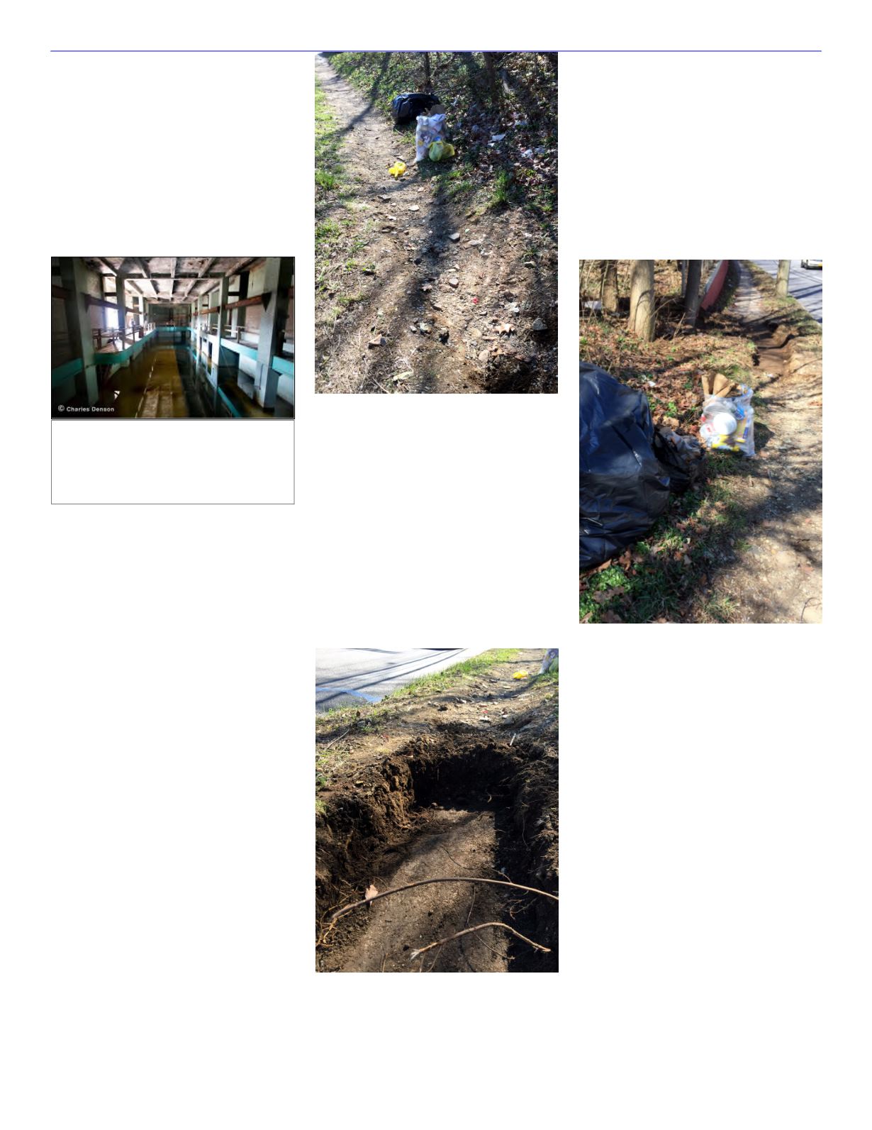
Interior of the decommissioned Co-
ney Island Pumping Station. The
pumps used to be in the lower level.
Copyrighted photo by Charles Denson,
2016. Reprinted with his permission.


